Drone Surveying Significance: The Details You Cannot Miss
Are you tired of manually surveying large areas of land? Do you wish there was a more efficient way to conduct land surveys without breaking the bank? Look no further than the innovative technology of drone surveying.
Drone surveying has revolutionized how we conduct land surveys, providing fast and cost-effective results. As the use of drones continues to grow in popularity, drone survey companies are becoming more prevalent. In this blog post, we will dive into drone surveying, exploring its functionality, cost-effectiveness and benefits over traditional manual surveys.
Understanding the Functionality of Drone Surveying
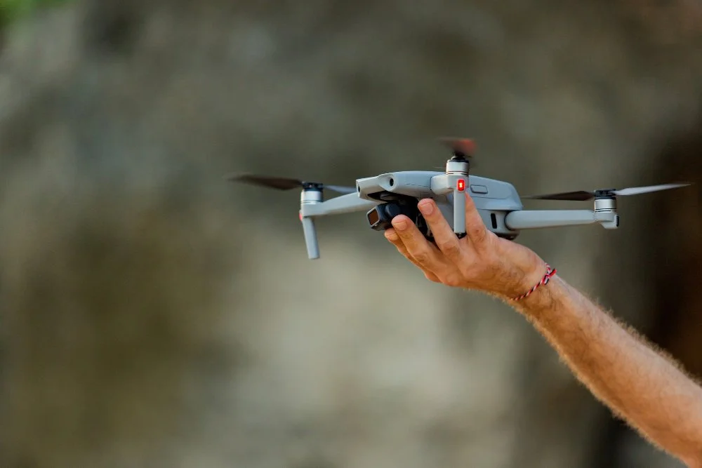
Drone surveying involves using unmanned aerial vehicles comprising sensors and specialized cameras to capture images and collect data on the survey site.
These images are then processed to create detailed 3D maps and models of the land, allowing surveyors to measure distances, elevations, and volumes easily.
Manual Vs. Drone Surveys: Which is More Cost-Effective?
When it comes to cost-effectiveness, drone surveying is the clear winner. In most cases, the national average cost of a drone survey is significantly less than that of a manual survey. That is because drone surveys can quickly focus on large land areas, with minimal human resources needed to complete the work.
Factors Impacting the Drone Surveying Price
Work Scope Matters
The cost of drone surveying largely depends on the scope of work required. Some projects may require more complex mapping and data collection, which can increase the cost.
The required data type, such as topographic, volumetric or thermal, can also impact the cost. The more detailed and comprehensive the surveying needs to be, the higher the cost.
Land Size is a Crucial Parameter
The size of the land undergoing a survey is another significant factor affecting drone surveying prices. The larger the land, the more time and resources are necessary for data collection, processing and analysis. The popular drone survey companies typically charge by the acre or square footage, so large-sized lands can be more expensive to survey.
Mentioning the Tolerances
Tolerances refer to the acceptable margin of error in a survey. The higher the accuracy required, the more expensive the surveying will be. The cost may increase if the project requires high-precision measurements, such as construction or engineering.
Drone survey companies may need to use specialized equipment or techniques to achieve the necessary level of accuracy.
Documentation Necessities
Another factor impacting drone surveying prices is the documentation requirements. Some projects may require more detailed reports, maps or 3D models, which can increase the cost.
Furthermore, additional fees and requirements may apply if the survey results need to reach regulatory authorities.
Travel Time and Research
The location of the survey site can also impact the cost of drone surveying. If the site is remote, traveling there may take more time and resources, increasing the overall cost.
Additionally, drone survey companies may need to research the site's regulations, airspace restrictions, and other factors affecting the surveying process.
The Technological Aspect That Drone Survey Companies Emphasize
Drone survey companies use the latest technology to ensure accurate data collection.
They use high-quality cameras, sensors, and software to capture and process data quickly and accurately.
The data is then analyzed using advanced algorithms, providing detailed reports and insights.
Drone Surveying: Why It's Better Than Manual Surveying
When it comes to land surveying, accuracy is crucial. The process involves gathering data and information about a site, which helps create maps, plans and other documentation.
Traditionally, manual surveying has been the preferred method for land surveying, but recent technological advances have led to the rise of drone surveying.
Ensuring More Data with Drone Surveying
One of the main benefits of drone surveying is that it can gather more data than traditional manual surveying methods. Drones can capture high-resolution images and videos of a site from different angles and altitudes, providing a comprehensive view of the surveyed area. That allows surveyors to collect more data points and information about the site, leading to more accurate and detailed maps and plans.
In addition, drones can come with specialized sensors such as LiDAR or thermal cameras, which can provide even more data about the site. LiDAR sensors can create 3D maps of the site, while thermal cameras can detect environmental temperature variations. This additional data can be helpful in various applications, including environmental monitoring, construction planning, and more.
Capturing the Survey Site Completely
Another advantage of drone surveying is that it can capture the survey site altogether, even in difficult or dangerous areas. Drones can fly over or around obstacles such as trees, buildings, and terrain features, allowing surveyors to collect data from every corner of the site.
Manual surveying, on the other hand, is limited by the accessibility of the site. If a site is difficult or dangerous to access, surveyors may not be able to collect data from those areas, leading to incomplete maps and plans.
Contemplating the Accuracy of Drone Surveys
Land surveying is critical to construction, land development, and other engineering projects. However, the traditional land surveying methods using total stations and GPS are expensive and time-consuming. Fortunately, the advent of drone technology has revolutionized land surveying, providing surveyors with an efficient and cost-effective alternative to traditional methods.
As mentioned earlier in this post, drone surveying companies use UAVs equipped with high-resolution cameras and other sensors to collect data and generate accurate 3D models of the land. The resulting data then helps create maps, digital terrain models, and contour maps essential in project planning and design.
Discover Accuracy and Efficiency with Carroll Surveying & Mapping - Contact Us Today
Are you looking for accurate and efficient land surveying services? Look no further than Carroll Surveying & Mapping! Contact us today to schedule your survey and get the peace of mind you deserve. Let us help you get the lay of the land!
"Let us be your guiding star,
Call Carroll Surveying & Mapping from near or far!"