Highway Construction: Mastering The Maze Of Surveying
The colossal task of highway construction requires not just heavy machinery and manpower but also the accurate and meticulous work of commercial land surveyors. Though often overlooked, this profession forms the lifeblood of any major construction process. Let's take a deep dive into the riveting world of commercial land surveying and its role in shaping our transportation infrastructures.
Road Ahead: Decoding The Secrets Of Highway Construction Surveys
Highway Construction Surveying is a crucial step preceding any road construction project. The process involves several stages:
Planning: A conceptual plan can identify the route through an extensive evaluation.
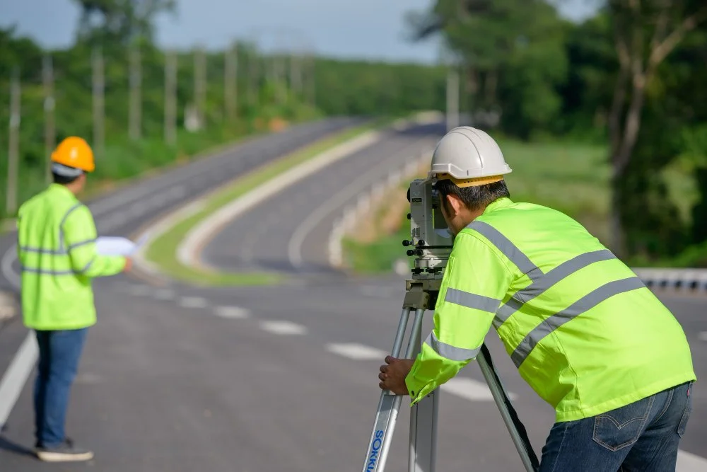
Preliminary Survey: A more detailed inspection of the selected routes is done by land surveyors. They scrutinize the terrain, analyze soil conditions and observe any environmental concerns.
Final Design Survey: The chosen route can provide specific details such as slopes, curves and elevations. This data helps in designing the final road.
Role Of Commercial Land Surveyors: Masters Of Land Surveying Mysteries
Commercial land surveyors perform pivotal roles when appointed for land surveying. They are:
Mapping the Topography: The first step for a surveyor is to understand the natural and man-made features of the land. They identify the area's physical characteristics, such as hills, rivers, trees and existing structures and document their positions. Understanding the terrain is critical for future construction as it influences the design and the types of materials used.
Identifying Boundaries: One of the most important functions of experienced land surveyors is establishing property lines. They determine the legal boundaries of the area to be surveyed using historical documents, legal deeds and on-site markers. It is crucial to avoid any potential disputes about property rights during and after construction.
Detailed Documentation: “A comprehensive survey isn't merely about identifying the physical features and boundaries.” It also involves a detailed documentation process where every tiny detail is recorded. That includes land measurements, the distances between different points and the elevation at various points. These measurements can create highly detailed maps and technical drawings, which serve as blueprints for engineers and architects.
Consultation and Guidance: Professional commercial land surveyors work in collaboration with others. They are integral parts of the design and construction teams, offering their expertise and advising on different aspects of the project. They can suggest the most suitable locations for structures, roads and utilities based on their thorough understanding of the land. Get an insight into potential challenges like drainage issues, soil instability or impact on local ecosystems.
Advanced Techniques: With the advent of technology, surveyors have added a new role to their portfolio – handling advanced surveying techniques. It includes GPS technology for precise measurements, drones for aerial surveys and laser scanners for 3D modeling. These technologies allow surveyors to provide highly accurate, detailed data and imagery that improve the efficiency and effectiveness of the design and construction processes.
Beyond The Finish Line: The Need For Additional Surveys In Road Building Projects
An additional survey post-road building is crucial and the reasons are multifaceted:
Verification: This ensures the construction has been carried out as per the original design and all the specifications have been met.
Identifying Discrepancies: Any changes in the initial design or unforeseen challenges during construction are documented.
Legal Obligations: An additional survey satisfies legal requirements, providing a construction record and confirming compliance with the set regulations.
Laser-Sharp Mapping: The Importance Of Laser Equipment In Modern-Day Cartography
Laser equipment, the cutting-edge technology in mapping, revolutionizes the way we look at surveying:
Increased Precision: Laser technology provides extreme precision in measurements, leading to highly accurate results.
Time and Cost-Efficient: It drastically reduces the time spent in surveying and hence, the overall costs.
3D Laser Scanning: Laser scanners capture comprehensive data to create 3D terrain models, allowing for better visual analysis.
Safety: Using laser equipment reduces the need for surveyors to access potentially dangerous terrains physically.
Ready To Transform Your Landscape? Let's Pave The Way Together!
Due to innovations like laser technology, surveying has come a long way from its traditional roots. Commercial land surveyors stand at the forefront of these advancements, ensuring that our roads are built accurately, efficiently and safely.
Whether it's highway construction or any other land project, one cannot overstate the significance of a skilled surveyor.
A well-surveyed land is the foundation for any successful construction project. For expert surveying services, trust "Carroll Surveying and Mapping," bringing state-of-the-art techniques and unmatched experience to the table. Connect with us today and pave the way to build a well-mapped highway.